Nossos serviços estão apresentando instabilidade no momento. Algumas informações podem não estar disponíveis.
-
Home

-
Geosciences
-
Methods and reference documents
-
Other technical documents
- NP-Novo Portal
RBMC - Brazilian Network for Continuous Monitoring of the GNSS Systems
Description
Set of geodetic stations, equipped with high-performance GNSS (Global Navigation Satellite Systems) receivers, which provide observations to establish coordinates once a day or in real time.
Warning
The RBMC has been making available, since January 1, 2020, 1-second tracking interval files in the RINEX 3 format. Detailed information about the publication and instructions for editing these files can be found below at Information on data with 1 second. The data with tracking interval of 15 seconds in the RINEX 2 and RINEX 3 formats from all RBMC stations remain available in the same way, unchanged, using HATANAKA compression and in the RINEX 3 format, only for stations with multi-constellation equipment.
Information on one-second data
In the context of the RBMC Improvement and Modernization Project, the RBMC made available on January 1, 2020 data with tracking interval of 1 second, in the RINEX 3 format, from the stations listed below:
| Station with data tracking interval of 1 second | Data from |
| ALMA (Maceió/AL) | August 1, 2021 |
| APMA (Macapá - DTCEA/AP) | August 1, 2021 |
| BELE (Belém/PA) | January 1, 2020 |
| BOAV (Boa Vista/RR) | January 1, 2020 |
| BRAZ (Brasília/DF) | January 1, 2020 |
| CEFE (Vitória (CEFET)/ES) | August 1, 2021 |
| CEFT (Fortaleza (Porto)/CE) | August 1, 2021 |
| CUIB (Cuiabá/MT) | August 1, 2021 |
| GOGY (Goiânia/GO) | August 1, 2021 |
| ITAI (Foz do Iguaçu - ITAIPU/PR) | October 22, 2020 |
| MGBH (Belo Horizonte/MG) | January 1, 2020 |
| MSGR (Campo Grande – EMBRAPA/MS) | January 1, 2022 |
| NAUS (Manaus/AM) | August 1, 2021 |
| PBJP (Joao Pessoa/PB) | August 1, 2021 |
| PERC (Recife - IFPE/PE) | August 1, 2021 |
| PITN (Teresina/PI) | August 1, 2021 |
| POAL (Porto Alegre/RS) | January 1, 2020 |
| POLI (São Paulo/SP) | January 1, 2020 |
| POVE (Porto Velho/RO) | January 1, 2020 |
| RIOB (Rio Branco/AC) | August 1, 2021 |
| RJNI (Niterói UFF/RJ) | August 1, 2021 |
| SALU (São Luís/MA) | January 1, 2020 |
| SAVO (Salvador/BA) | January 1, 2020 |
| SEAJ (Aracaju/SE) | August 1, 2021 |
| SJSP (São Jose dos Campos/SP) | August 1, 2021 |
| TOPL (Palmas/TO) | January 1, 2020 |
| UFPR (Curitiba/PR) | January 1, 2020 |
The project also foresees the gradual improvement of the stations with data in 1 second.
The data are organized into files of 15 minutes, due to the storage size, and are published every 15 minutes on the IBGE ftp server ftp://geoftp.ibge.gov.br/informacoes_sobre_posicionamento_geodesico/rbmc/
dados_RINEX3_1s/. The structure of the directories and the step by step for joining the files, as well as the conversion into the RINEX 2 version can be accessed here.
The data with tracking interval of 15 seconds in RINEX 2 and RINEX 3 from these stations and from the other RBMC stations remain available in the same way, unchanged, using HATANAKA compression, and in the RINEX 3 format, only for stations with multi-constellation equipment.
Information about the Hatanaka compression
Since December 21, 2017, the RBMC has made available all the observables tracked by the receivers, that is, depending on the model of the receiver, the observation file may contain all the observables tracked from the GPS, GLONASS, GALILEO and SBAS constellations, improving the post-processing service with respect to the number of observations and constellations. Thus, in order to reduce the size of the files and facilitate the download, we now use the HATANAKA compression format.
The HATANAKA compression algorithm was developed by Japanese researcher Yuki Hatanaka, from the Geospatial Information Authority of Japan (GSI). Its strategy consists of joining redundant information, thus allowing a significant reduction in the file size.
With the introduction of new GNSS constellations and the addition of new observable information implemented in the modernization of the systems, the observation files tend to significantly increase in size over the next years.
Therefore, we describe the major advantages of using Hatanaka:
1. Space saving in the storage devices;
2. Performance gains in the download;
3. Possibility of a larger time series of data online.
To decompress the file, the CRX2RNX program should be downloaded from the GSI page (http://terras.gsi.go.jp/ja/crx2rnx.html). Aiming at helping the users in the conversion, we made also available a step by step to carry out the procedure.
The CRX2RNX software made available by the GSI is freeware. Users are expected to notice what is described in the LICENSE.txt file.
Learn more about Hatanaka at https://www.unavco.org/software/data-processing/preprocessing/preprocessing.html#hatanaka
Information about RINEX 3
The RINEX 3 format supports all the signals from the GPS, GLONASS, Galileo, BeiDou, IRNSS, QZSS and SBAS constellations. Therefore, the RBMC stations equipped with multi-constellation GNSS receivers, those able to track constellations other than GPS and GLONASS, started having their data made available in the RINEX 3 format as of August 30, 2018.
The files are made available daily with a interval of 15 seconds at ftp://geoftp.ibge.gov.br/informacoes_sobre_posicionamento_geodesico/rbmc/dados_RINEX3/, with double compression, Hatanaka (.crx) and gzip (.gz).
The navigation file is published apart in the /ano/orbitas/ directory.
The nomenclature of the files follows the universal structure described below:
tracking data file in the RINEX 3 format:
XXXX00BRA_R_AAAADDDHHMM_01D_15S_MO.crx.gz
XXXX00BRA – Station name, station type and country code;
R – File generated by a GNSS receiver;
AAAADDD0000 – Year, day of the year, hour and minute;
15S – tracking interval;
MO – Indicates it is an observation file;
crx – Hatanaka compression;
gz – Gzip.
Navigation file in the RINEX 3 format:
BRDC00WRD_R_AAAADDDHHMM_01D_MN.rnx.gz
MN – Indicates it is a navigation file
More information about the RINEX 3 format at https://kb.igs.org/hc/en-us/articles/201096516-IGS-Formats
Access to RINEX 3 data - ftp://geoftp.ibge.gov.br/informacoes_sobre_posicionamento_geodesico/rbmc/dados_RINEX3/
To access the RBMC-IP page, click here.
To access the RBMC Twitter, click here.
About the publication - Brazilian Network for Continuous Monitoring of the GNSS Systems
About the RBMC
The use of the GNSS (Global Navigation Satellite System) technology revolutionized the activities of navigation and positioning. The geodetic and topographic works became faster, more precise and more economic. As long as the positioning techniques evolve, a number of applications in real time and post-processed have appeared, improving the role of the RBMC.
The geodetic and topographic applications of the GNSS imply the use of the relative method, i.e., at least one station with known coordinates is also occupied at the same time as the occupation of the desired points. The RBMC stations perform exactly the role of the point with known coordinates belonging to the Brazilian Geodetic System - SGB, freeing the user from immobilizing a receiver in a specific point which, many times, is hardly accessed. In addition, the receivers of the RBMC stations have high performance, providing observations of high quality and reliability.
Characterization
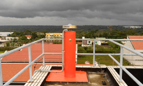
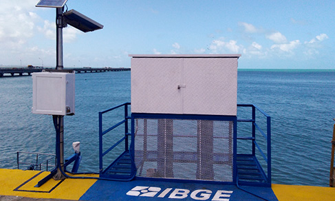
RBMC stations are made of forced centering pins, especially designed, and embedded in stable pillars. Most receivers of the network are able to trace GPS and GLONASS satellites, while some of them trace GPS only. These receivers continually collect and store the observations of the code and phase of the carrier waves transmitted by the satellites of the GPS or GLONASS constellations.
Each station has a geodetic antenna and receiver, Internet connection and continuous supply of electricity, which allows the continuous operation of the station.
The coordinates of the RBMC stations are another key component of the final results of the surveyings referenced to them. In this aspect, the major advantage of the RBMC is that all its stations belong to the SIRGAS (Geocentric Reference System for the Americas) Reference Network, whose final coordinates have nearly ± 5 mm of precision, being one of the most precise networks in the world. Another important role of the RBMC is that its observations are contributing to the regional densification of the IGS (International GPS Service for Geodynamics) network since 1997, assuring a better precision for the IGS products – such as precise orbits – over the Brazilian territory.
Operation
The operation of the RBMC stations is completely automated. Still in the memory of the receiver, the observations are organized into daily files corresponding to sessions starting at 12:01 am and closing at 12:00 am (universal time), with tracing interval of 15 seconds.
After closing a session, the files and their respective observations are transferred from the receiver to the Control Center of the Brazilian Network of Continuous Monitoring of the GNSS Systems - RBMC – Kátia Duarte Pereira, in the Coordination of Geodesy (Rio de Janeiro - RJ). From this point onwards, new files in the standard RINEX 2 format are created, in which the quality control of the observations is carried out. Then the RINEX 2 data files and the orbits transmitted are compressed and made available in the download area of the IBGE portal.
Occasionally, some loss of data due to problems in the Internet connection and lack of energy can occur and are immediately reported through the RBMC Twitter (https://twitter.com/IBGE_RBMC). As far as possible, the data are recovered as soon as the situation is back to the normal condition. However, some data can be lost due to memory limitation in some receivers. In the face of it, we recommend to check with the supplied channels the condition of the station that will be used before carrying out any surveying.
Note: we ask RBMC users to cite that the data were provided by the IBGE, sponsor of the RBMC project, in their works. We also ask RBMC users to not pass the data on, yet guide other users to download them on the IBGE page (RBMC) or request them directly to the IBGE through email ibge@ibge.gov.br.
More on the product - Brazilian Network for Continuous Monitoring of the GNSS Systems
Data analysis of the Brazilian Network for Continuous Monitoring of the GNSS Systems (2006-2010)
Access hereLearn more - Brazilian Network for Continuous Monitoring of the GNSS Systems
Downloads
News and Releases
Brazilian Network for Continuous Monitoring of the GNSS Systems
New application helps users obtain data in a personalized way
This Tuesday (June 28th), the IBGE publishes the page for personalized download of data from the Brazilian...
28/06/2022
Brazilian Network for Continuous Monitoring of the GNSS Systems
Report shows 20-year monitoring of geographic coordinates
Twenty years of movements of the earth's crust, recorded by means of determining coordinates and velocity...
16/12/2021
Brazilian Network for Continuous Monitoring of the GNSS Systems
From large works to prevention of disasters, get to know the functions of geodetic networks
Establishing coordinates for infrastructure works. Demarcating agricultural land. Detecting disturbances...
29/01/2021
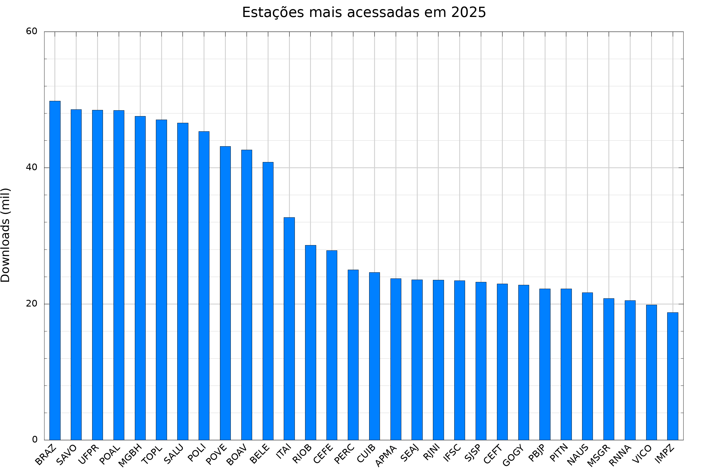
Dados diários e situação operacional
Clique nas estações para ver detalhes sobre cada uma
-

Estações operantes
-

Estações em estado
de advertência -

Estações inoperantes
(sem dados há mais de 6 dias) -

Estações inativas
-

Estações RINEX 3, 1 segundo
-

Estações RINEX 3, 15 segundos
-

Estações RINEX 2, 15 segundos
Estações em Advertência e Inoperantes
Desculpem-nos pelos transtornos ocasionados. Estamos empenhando esforços na tentativa de solucionar as questões acima citadas.
Consulta de disponibilidade de dados:
Dia do Mês Dia do Ano 2026
Selecione o dia desejado:
Para consultar os gráficos de anos anteriores, desde o início da operação da RBMC, selecione um dos relatórios abaixo:
- Análise dos Dados da RBMC - 1996 a 2000
- Análise dos Dados da RBMC - 2001 a 2005
- Análise dos Dados da RBMC - 2006 a 2010
- Análise dos Dados da RBMC - 2011 a 2012
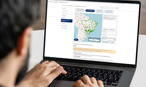
Pesquisa combinada para download
Atenção:
- Para mais informações (estações em manutenção, novas estações, etc.) veja o item Situação Operacional.
São disponibilizados dois tipos de arquivos, sendo eles:
- Relatório da estação
Fornece detalhes sobre a estação da RBMC, incluindo a altura da antena e coordenadas precisas da estação(xxxx.PDF, sendo xxxx o código da estação). - Arquivos de dados
São arquivos de observações GNSS (.AAo - AA representando os dois últimos dígitos do ano) compactados no formato Hatanaka (exemplo: BRAZ033.17d), navegação (exemplo: BRAZ033.17n e BRAZ033.17g) e, meteorológicos, quando a estação for equipada com sensores meteorológicos (exemplo: BRAZ03471.17m). Estes arquivos são identificados como xxxxddd1.ZIP, sendo ddd o dia do ano e xxxx o identificador da estação.
Os arquivos de observação estão no formato Hatanaka e podem ser descompactados para o formato RINEX 2.11 para o processamento. Para isso, siga este passo a passo.
Por exemplo, um pedido de dados das estações Viçosa e Bom Jesus da Lapa, para os dias 2 e 3 de fevereiro, resultaria no fornecimento dos arquivos BOMJ0331.ZIP VICO0331.ZIP e BOMJ0341.ZIP VICO0341.ZIP.
Rede Brasileira de Monitoramento Contínuo - RBMC
Resultado da pesquisa - Download
-
Dados disponíveis
-
Dados não disponíveis
-
Fora do período da atividade da estação
Resultado do processamento
Clique nas estações do mapa para incluir na lista.
Para remover, clique no item da estação correspondente
Calendário Dia do ano