Nossos serviços estão apresentando instabilidade no momento. Algumas informações podem não estar disponíveis.
Environmental studies
Although the Amazon was the biome with the biggest area in the national territory, the Atlantic Rainforest is predominant in the biggest number of...
Mapping
The IBGE launches today (07) the 2022 Block-Face Database for Brazilian Addresses in digital format. The product consists of a graphic representation...
Geosciences
In celebration of the World Environment Day, the IBGE is releasing today (6) the report of the second Workshop on the Brazilian System of Relief...
Cartography
The IBGE released on Tuesday, May 7, the 2022 Municipal Maps Collection, with mapping results for the 5.568 municipalities in Brazil, the Federal...
This Monday (29), the IBGE releases volume 36 of the Surveying of Natural Resources, from the RADAMBRASIL project. This new volume, entitled "Folha...
The IBGE has released today (April 25) the second edition of volume 68 of the Brazilian Journal of Geography (Revista Brasileira de Geografia - RBG)....
Biodiversity
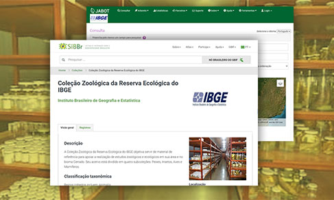
Starting this Monday (25), the IBGE will make available a new webpage dedicated to its biological collections, which are located in the institute's...
RBMC
The IBGE started operating six mew stations of the Brazilian Network for Continuous Monitoring (RBMC) of GNSS systems for accurate georeferencing...
IBGE launches today (7) a new version of the Continuous Vector Cartographic Base of Brazil at scale 1:250,000, which will be 10 years old. This is...
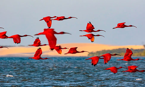
The IBGE released, today (23), an assessment of existing data on biodiversity in Brazil in 2022. The unprecedented study mapped, with a statistical...
bdia
The IBGE releases today (7) the updating of the Environmental Information Database (BDiA), which gathers the collection of thematic bases of natural...
RBG
Today (27), the IBGE releases the first issue of volume 68 of the Revista Brasileira de Geografia - RBG (Brazilian Journal of Geography). The publication...
Physical geography
The IBGE released today (29) an unprecedented publication with the travel plan and discussions related to a technical expedition organized by the...
Experimental survey
The IBGE released this Wednesday (16) the study “Methodological Proposal for the Classification of Rural, Urban and Nature Spaces in Brazil”, whose...
Territorial divisions
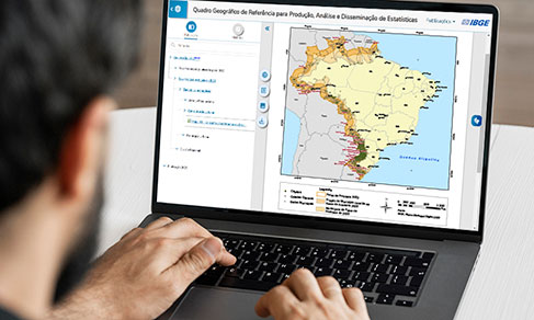
The IBGE released today (19) the 2022 edition of the Geographic Reference Framework for the Production, Analysis and Dissemination of Statistics,...
The IBGE released today (17) the Geographical Names Collection Manual, which details the methodology developed and used to collect place names. Based...
BC100 Project
The IBGE publishes today (29) the Continuous Vector Cartographic Base of the State of Acre, on a scale of 1:100,000. This is the seventh state, the...
Environmental-Economic Accounting
The IBGE released today (24) the updated data on threatened species for year 2022. This set of information is part of the survey “Ecosystem accounts:...
The IBGE releases today (April 26) the second number of volume 67 of the Revista Brasileira de Geografia (RBG) (Brazilian Journal of Geography),...
Territorial Structures
The IBGE publishes today (March 29) the update of three annual Geosciences studies: Digital Municipal Meshes 2022; Update of Municipal Maps and Territorial...
Nós utilizamos cookies para melhorar sua experiência de navegação no portal. Para saber mais sobre como tratamos os dados pessoais, consulte nossa Política de Privacidade.